
How to use Kakao maps and Naver maps
I know for some of us coming to a different country everything might seem confusing, especially if you're not used to taking different types of transportation. Using google Maps might not work due to some areas not being updated and precise locations are not picked up accurately.
These two apps are a great way to get around. The left side is Kakao Maps and the right side is Naver Maps. Both are great apps to use, try using both apps and see what you prefer to use.
Step 1: Download Kakao Maps / Naver Maps
![]()
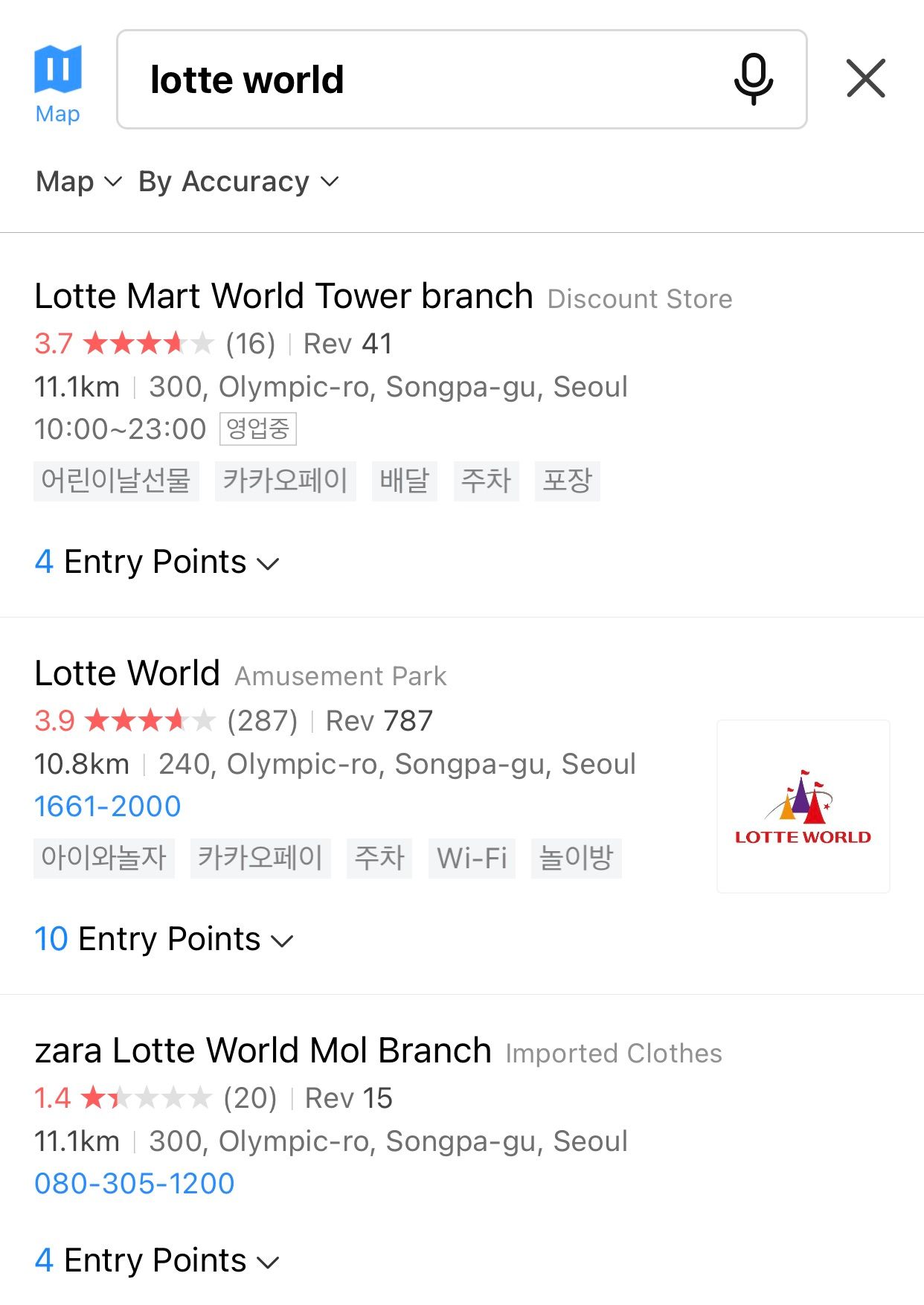
Step 2: Type in your Destination
After you click your place, each destination gives a brief description, rating, photos, and opening times, which makes it very helpful.

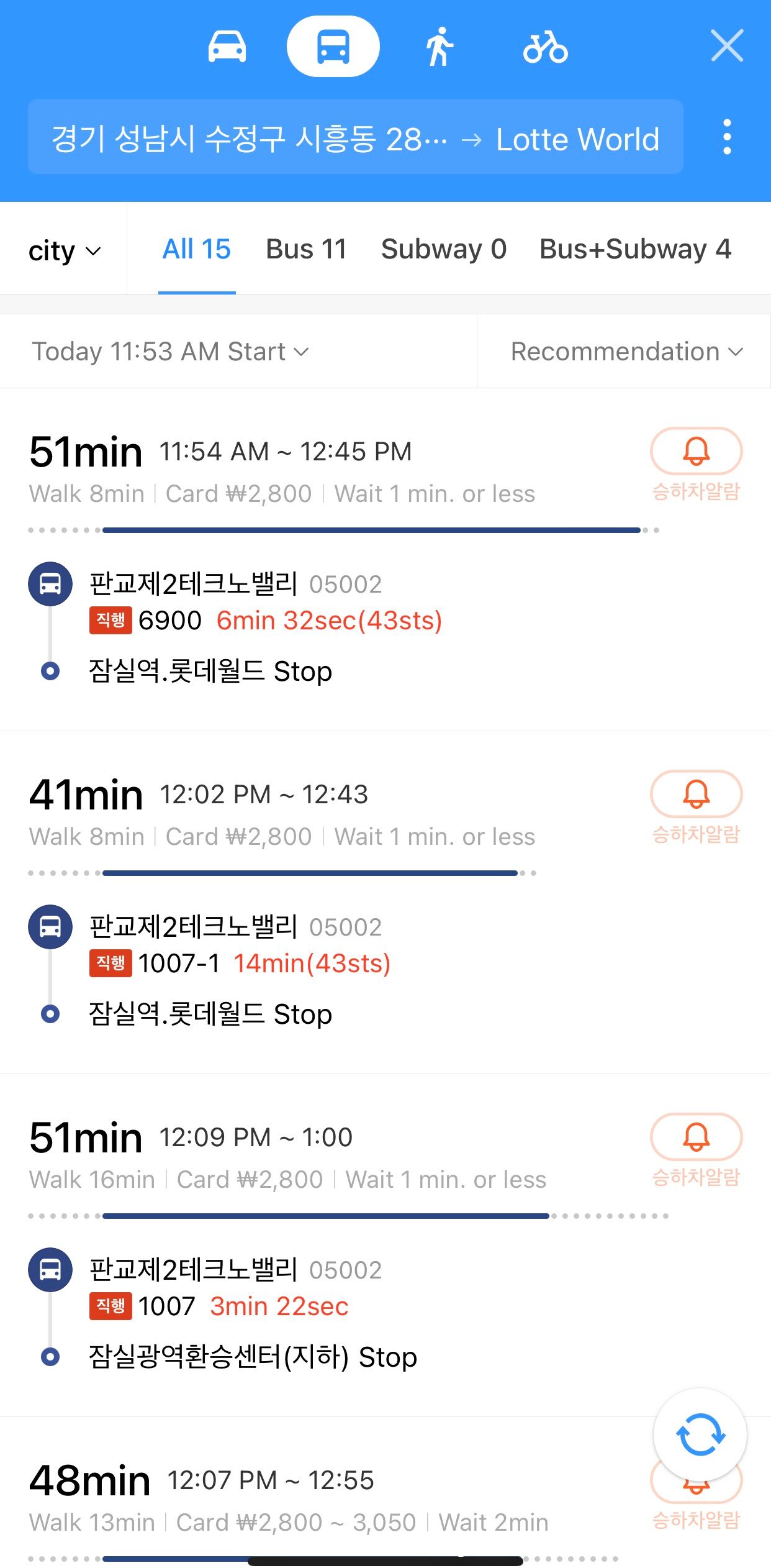
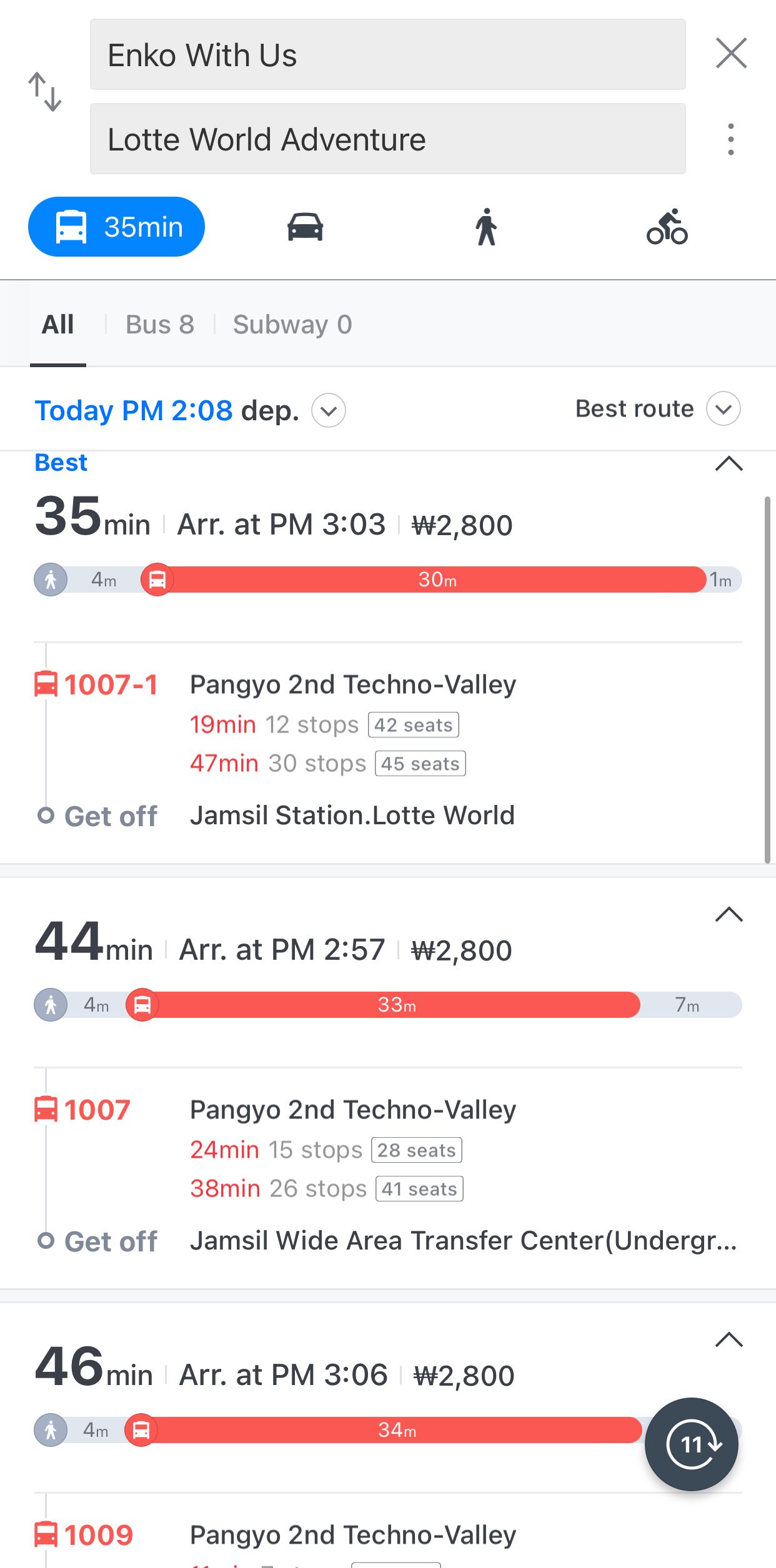
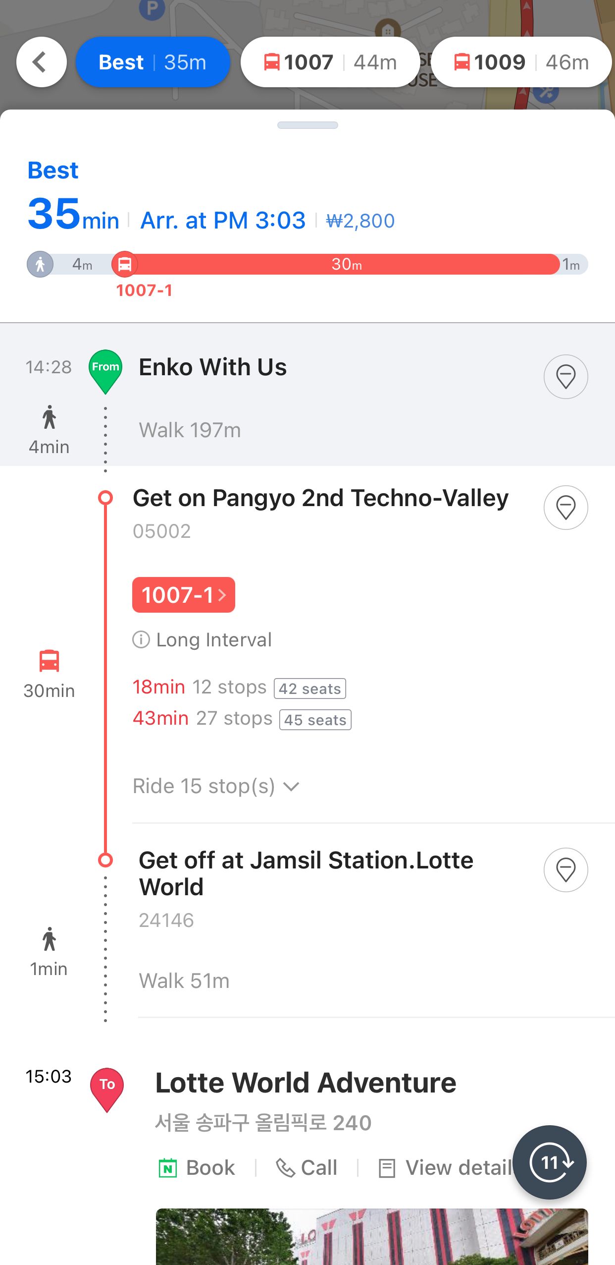
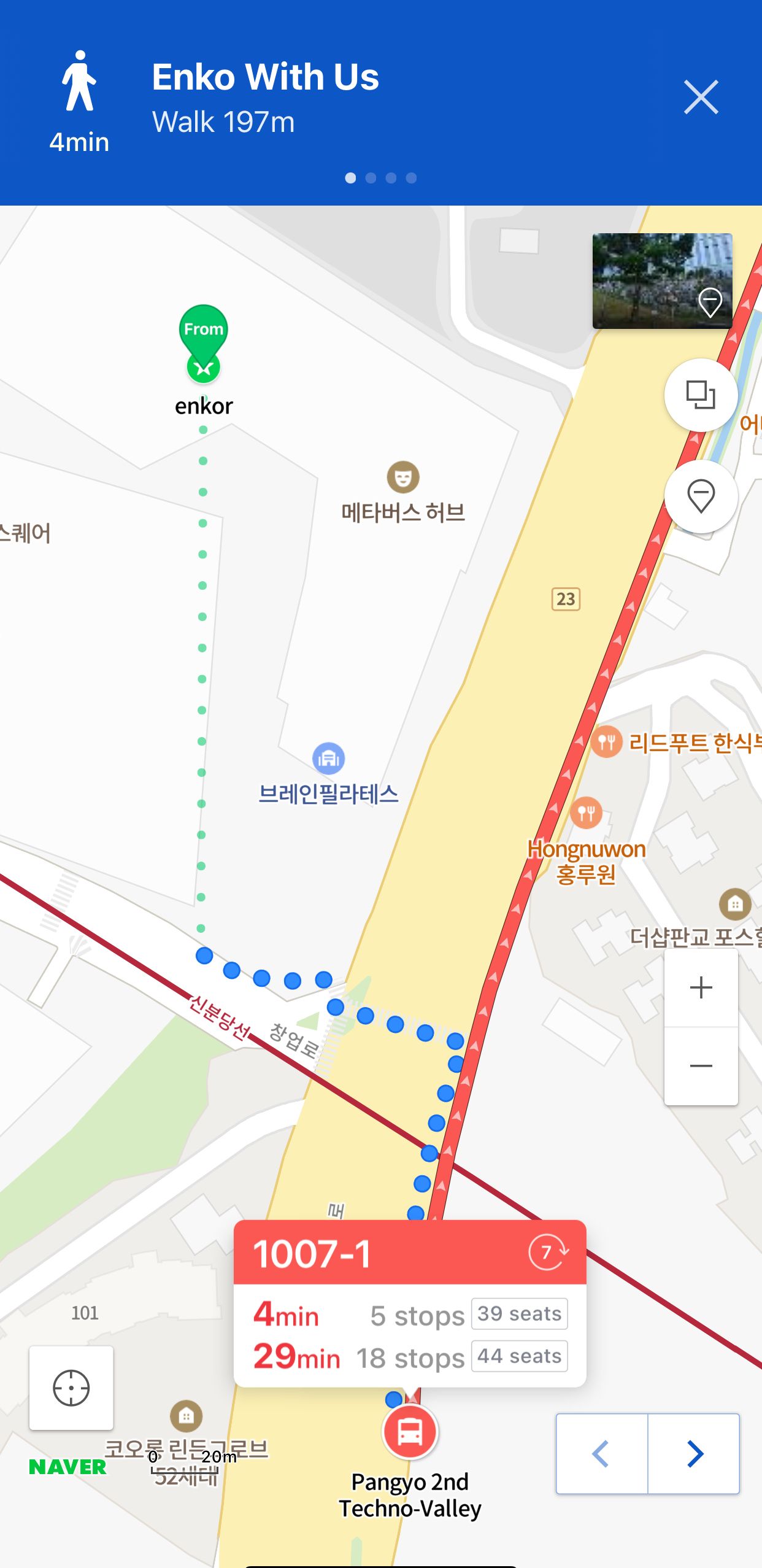
Step 3: Select your way of Transportation
You can use different types of transportation by car, bus, subway, walking, or bike. It also tells you the wait times of the buses and subways, how long the walk will be and how much you will be paying for the trip. It also tells you how many seats are available and how many stops are left to where you’re at. Usually, the fare will cost a little bit more when traveling past 11 pm. Here’s a link to how to take the bus in detail on our website!
 .
. 
Subway Maps
If you decide to take the subway, a helpful guide to use on Kakao and Naver maps is the subway lines map. Click the top left corner on the search bar, then click subway map, then it will map will appear
 Step 1 Then you click the station you are located at and then click the station you want to go to.
 Step 2
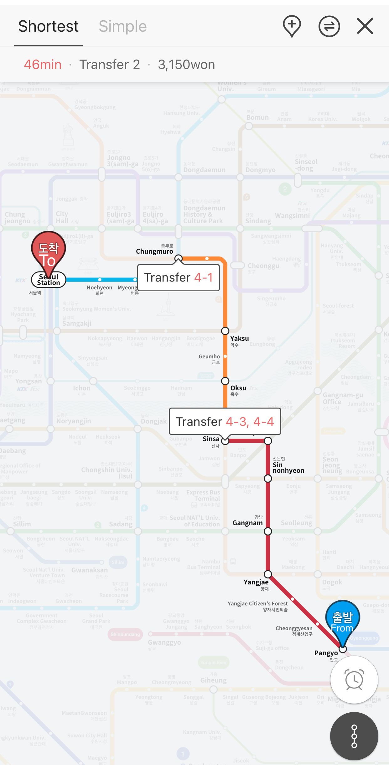
 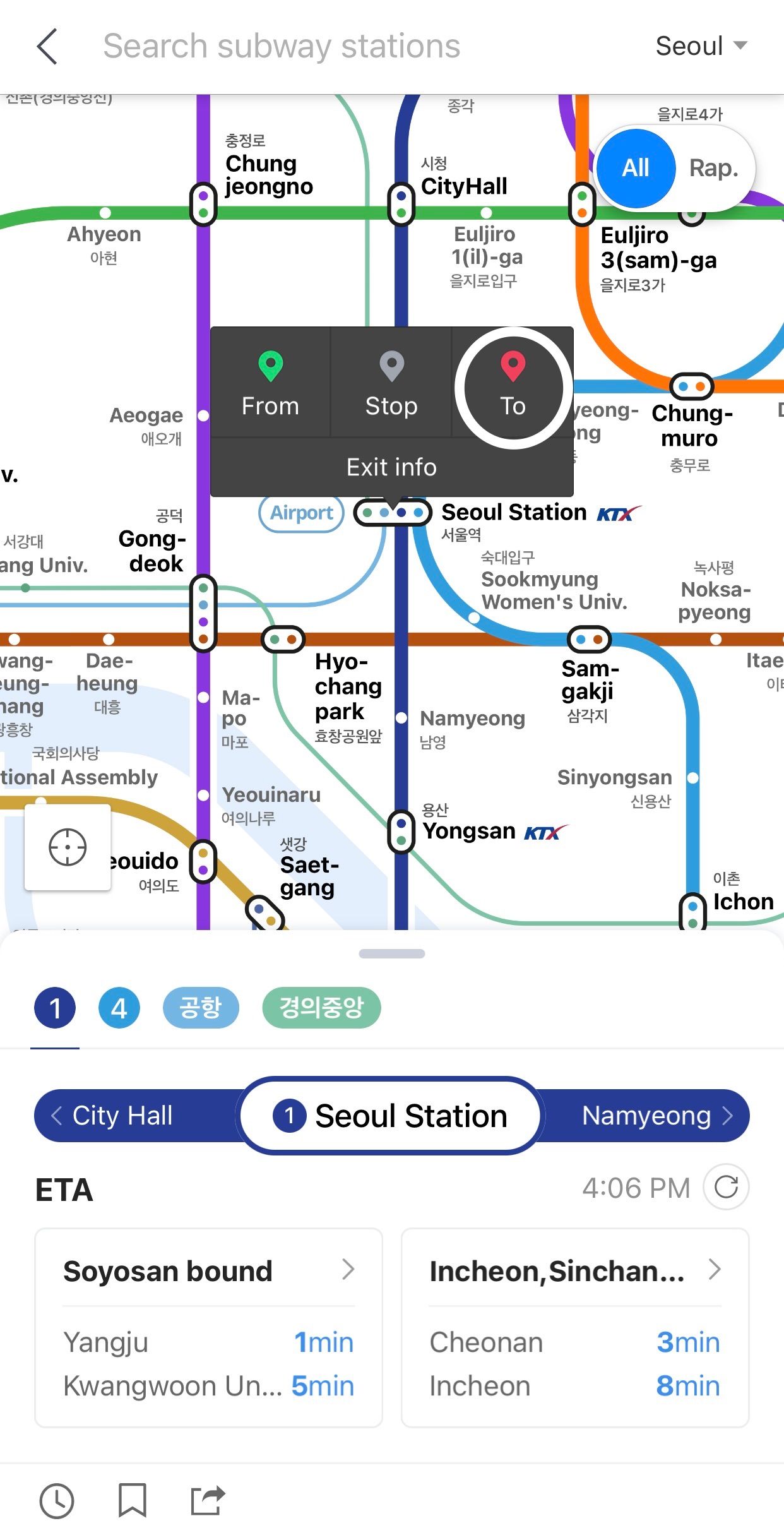 Step 3 Last it will show you the shortest or simplest route to your destination with the transfer numbers that will get you there easier.
 Step 4## Step 4: Select how you want to get there
Once you select the way of transportation and how you want to get there; get on the stated numbered bus, and if you miss the bus you can either wait for the next one, or it will give you another bus to get on that has the same route.

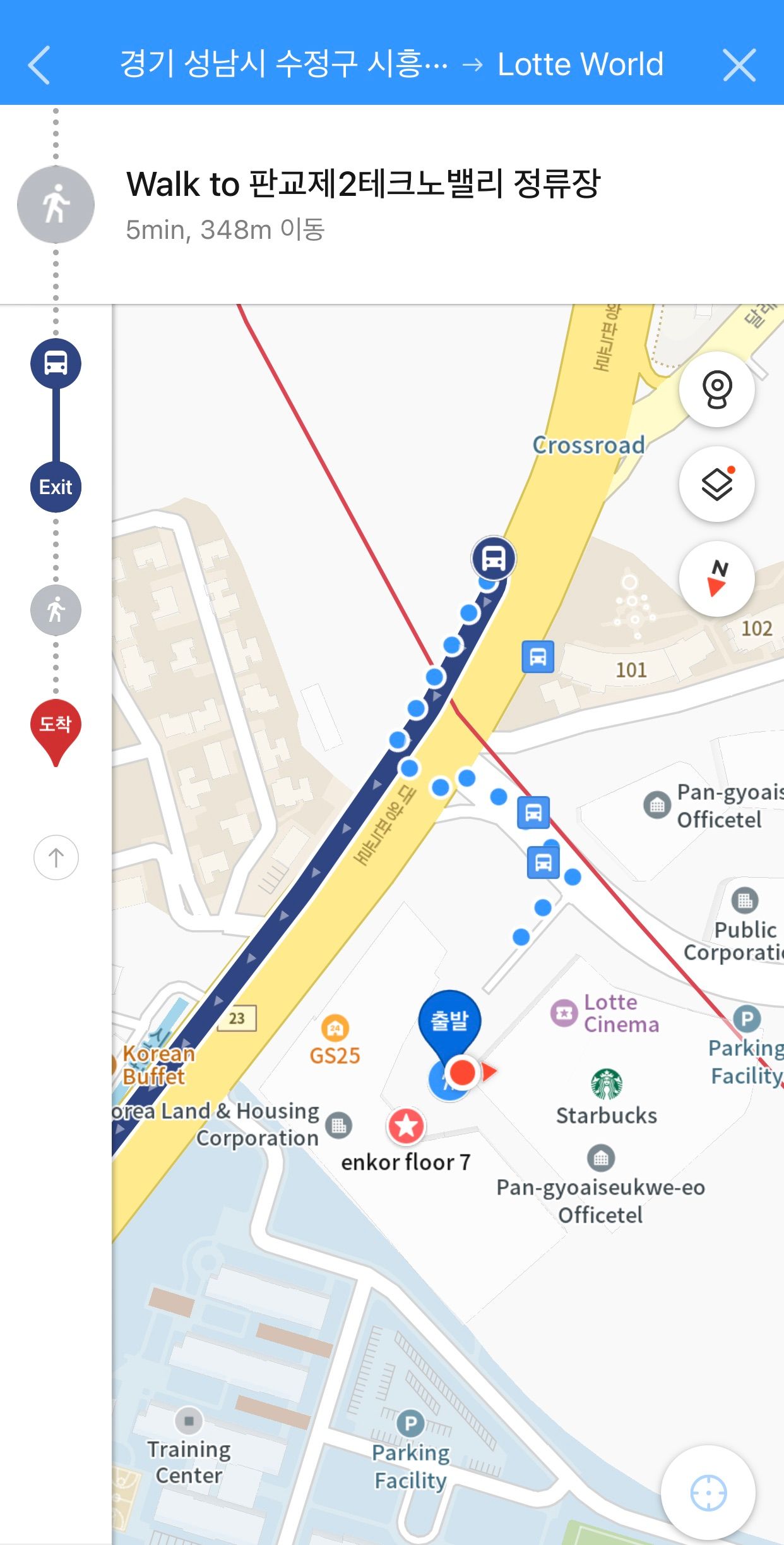
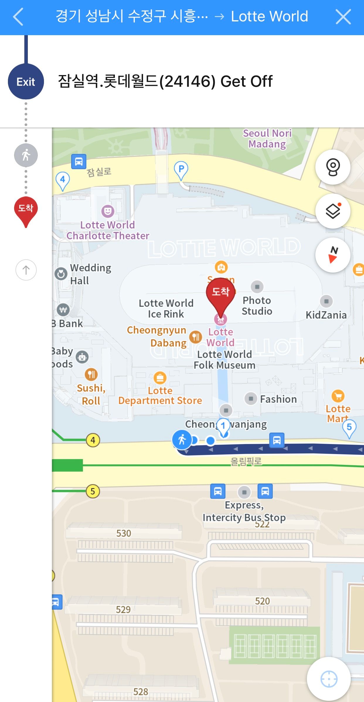
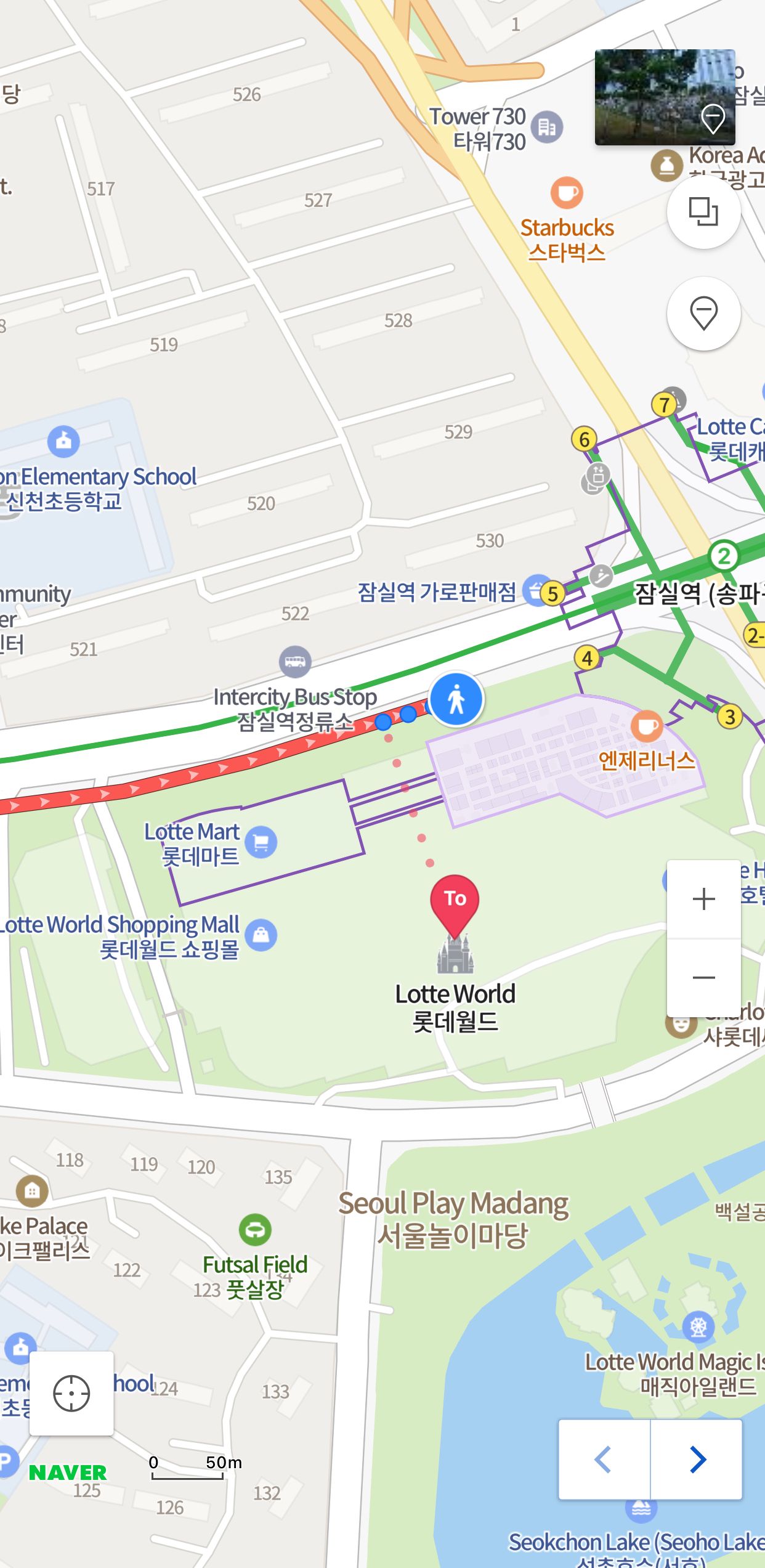
Step 5: Follow the way
Next is to follow the directed way to get to the bus, walk to the bus stop, scan your T-money card before your trip, and ride the bus until you arrive at your exit. When you get close to your exit, press the stop button that is usually next to the window and scan your T-money card again before leaving the bus.
The purpose of scanning your T-money card is to record how long you travel and if you don’t scan it the second time it will charge you as if you took the whole route of that bus schedule.
Step 6: Arrived Destination!
Once you get to your exit, you walk to your destination and enjoy your time where you are.
🔥Follow us on our social media pages for more activity updates and tips on living in Korea
Instagram - Facebook - Twitter